Easiest
Rim only
Panorama, no descent
See the Malang tripSee where it sits on the map
Brief reply
The Tumpak Sewu viewpoint that shows the whole curtain of water is the upper panorama, about a 10-minute walk from the car park, while the base takes a trek of 30 to 45 minutes down.
Time, hours, light
17 places to find
Choose a layer, then touch a pin or a name for its note and a Google Maps link.
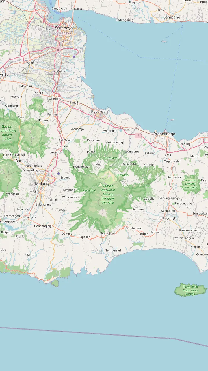
The usual starting city; by private vehicle the drive to the falls takes about 2 to 3 hours.
Google MapsA tiered fall about 120 m high between the Pronojiwo and Ampelgading districts.
Google MapsAn active volcano 2,329 m high in the Tengger mountains.
Google MapsDescribed as 200 meters high, in Probolinggo Regency inside the national park.
The town is about 1 to 2 hours from the falls by road.
Madakaripura lies about 30 km from the centre of this city.
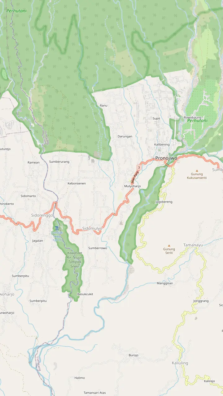
From the car park a walk of about 10 minutes leads to the upper viewpoint.
Google MapsThe cave is one of three attractions on the one-gate ticket introduced on 24 December 2024.
A waterfall roughly 100 m high, reached by 1.3 km of trekking from its parking lot.
The town sits about 50 km by road from the centre of Lumajang.
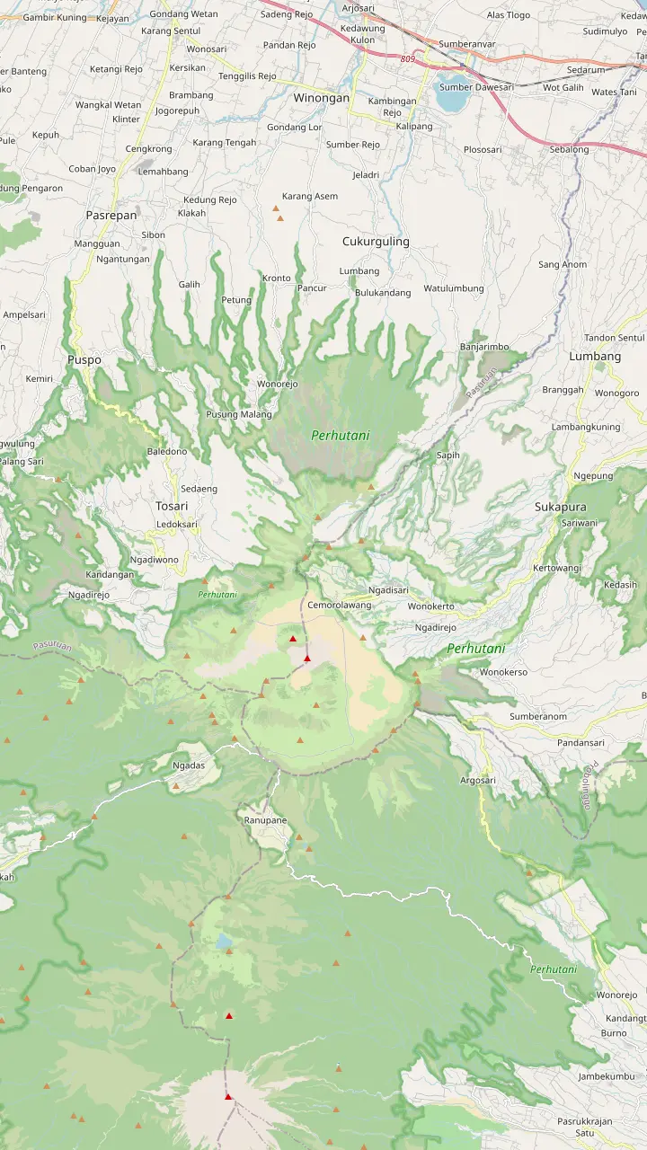
The walk in crosses the river several times.
The village from which the volcano is about 45 minutes away on foot.
Foreign visitors pay Rp255,000 a day for the national park ticket.
Google MapsStands on the sand plain below the crater, which has been protected since 1919.
The viewpoint rises to 2,770 m.
One of two gates that stayed open when the Jemplang entrance closed on 10 September 2026.
Closed to Bromo visitors from 10 September 2026 after a fire at Sabana Pengol.
Base map data © OpenStreetMap contributors
Tumpak Sewu has an upper panorama near the car park and a base at the foot of a slippery descent. Here is what each Tumpak Sewu viewpoint shows, what it costs in time and how to fit both into one visit.
Editorial team, tumpaksewuwaterfall.top · Updated November 2, 2026 · A read of about 6 minutes
Essentials in a minute
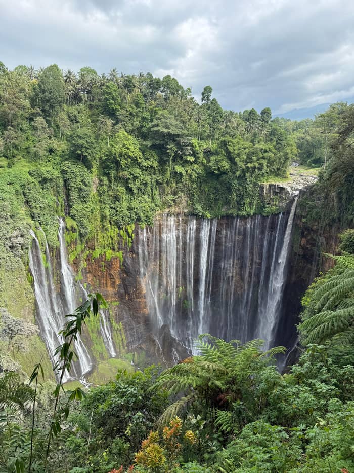
Tumpak Sewu is built like an amphitheater, and its two main viewpoints sit at opposite ends of it. From the upper viewpoint you can photograph the whole formation of water curtains at once, while from the valley floor you stand right in front of the falling water.2 The two views answer different questions. One tells you what the place looks like; the other tells you what it feels like to be small beside it.
The upper viewpoint is the easy one. From the car park it is a walk of about 10 minutes.1 It suits anyone who cannot or does not want to descend, and it is also where the scale of the falls registers most clearly: the waterfall is about 120 m high and spreads across a half-circle cliff like a wide curtain.4 Bring a lens or a phone setting that can take a wide frame, because the whole point of this view is its width.
The base is the committed one. Going down takes a trek of 30 to 45 minutes over bamboo stairs, a stony path and slippery ground.3 Coming back is the same trek in reverse, and Wikipedia's entry on the falls says the way in or out is physically demanding and may take about an hour.8 Go down only if your legs and your schedule allow a climb back out, and wear shoes that grip rather than flip-flops.
Viewpoint by viewpoint
| Spot | Minutes afoot | What it frames | Fits when |
|---|---|---|---|
| Upper panorama | A 10-minute walk1 | The whole curtain at once2 | Wide shots, Semeru on clear days5 |
| Base of the falls | 30 to 45 minutes down3 | Right in front of the water2 | Close-ups, spray and scale |
| Goa Tetes | 30 minutes beyond the base | The cave waterfall | You still have energy left |
| Kapas Biru | 1.3 km trek11 | A waterfall roughly 100 m high12 | A second outing with a driver |
| Kabut Pelangi | 1.4 km trek13 | A waterfall roughly 75 to 95 m high14 | Paired with Kapas Biru |
Times and heights are as the sources state them. Kapas Biru and Kabut Pelangi are separate Pronojiwo attractions, not part of the one-gate ticket for Tumpak Sewu.15,12
The panorama sits at about 500 m above sea level on the slope of Mount Semeru, the highest mountain on Java.5,9 On a clear day the silhouette of Semeru shows behind the falls from the main viewpoint.5 That condition matters for pictures: a hazy morning gives you the falls on their own, a clear one gives you the falls and the volcano in a single frame.
Timing for the panorama is about light and mist more than about gates. The site opens daily at 07.00 and closes at 15.00 WIB, which leaves a long window on either side of midday.6 A government tourism page for the neighboring Pronojiwo waterfalls recommends arriving between 9 and 11 in the morning for Kabut Pelangi and Kapas Biru.10 Treat that as a hint about the valley's light, not as a rule for Tumpak Sewu, which that page does not cover.
Photographs from the rim reward patience. Mist drifts across the valley and the curtain clears and fills again, so wait for a clean moment instead of taking the first frame. Keep a lens cloth in your pocket for the fine spray that falling water throws over a wide space. And take the picture early in your visit: the panorama is the part of the day that is easy to return to if you want a second try.
The clock, spot by spot
The base is where the postcard picture stops being a picture. You stand right in front of the falling water,2 and the mist and the noise become part of the view. The trek from the top takes 30 to 45 minutes on bamboo stairs, a stony path and slippery ground.3 One Tumpak Sewu day-trip listing says around 90% of its trek is through water, so wet shoes are part of the plan rather than an accident.
Boots can be rented from lodgings near the site for Rp10,000 to Rp20,000 a pair.16 Water shoes are hired out on site, the same listing adds, though not in every size. If your feet are an unusual size, bring your own pair that you do not mind soaking, and check that the soles grip wet stone.
Where you stand at the bottom changes the picture. Close in, the curtain fills the frame and the height is felt rather than seen; further back the tiers separate into single streams. Move before you decide which you prefer. Carry the camera in a dry bag between shots: the day-trip listing advises a dry bag or poncho and a waterproof phone cover for exactly this walk.
Match the spot
Match the spot to your legs, your gear and what the camera should catch.
If I want one picture of the whole falls
The upper panorama
It shows the whole formation of water curtains at once and is about a 10-minute walk.2,1
If I want to feel the water on my face
Go down to the base
From the valley floor you stand right in front of the falling water.2
If My knees dislike long stairs
Stay on the rim
The way down is bamboo stairs, a stony path and slippery ground, and the way in or out may take about an hour.3,8
If I have half a day spare afterward
Add Kapas Biru
It is roughly 100 m high and a trek of 1.3 km from its parking lot.12,11
If I will arrive late in the afternoon
Mind the gate closing
Gates are open from 07.00 to 15.00 WIB.6
Choose your depth
Easiest
Panorama, no descent
See the Malang trip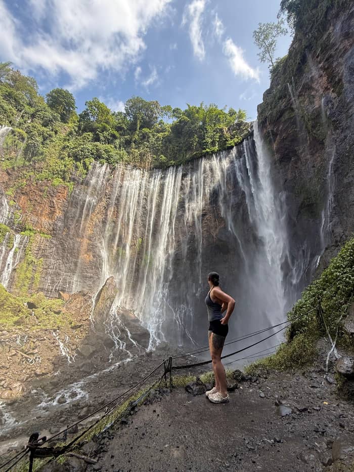
Fullest view
Panorama, then the valley floor
See the Malang trip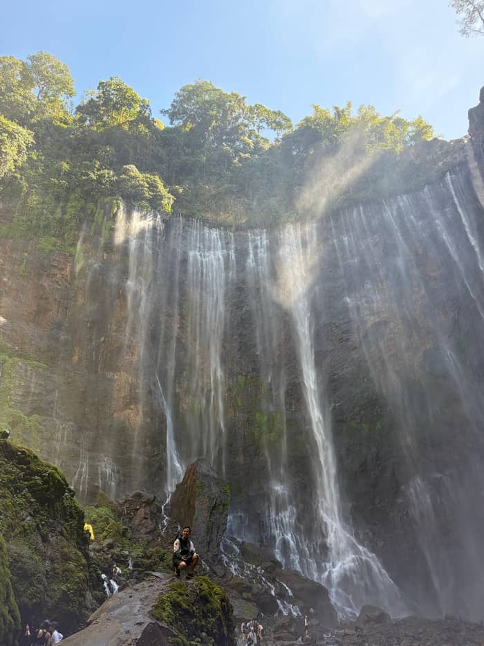
With a leader
Adds the Goa Tetes cave waterfall
Tumpak Sewu is the name on the ticket, but the valley holds more than one waterfall. Since 24 December 2024 a single ticket has covered the Tumpak Sewu waterfall, Goa Tetes and Panorama Grojokan Sewu, all in Sidomulyo village.15 Lumajang later merged the Tumpak Sewu and Grojogan Sewu names into one: Wisata Tumpak Sewu.29 If you see the older names on a sign or a receipt, they belong to the same system.
Goa Tetes is the cave waterfall off the base. Once you are down, the same day-trip listing adds 30 minutes to reach the Goa Tetes cave waterfall. It is the third spot on that listing's route, after the panorama and the base, and a useful reminder that the ticket covers more than the famous curtain.
Kapas Biru is a separate waterfall in Pronojiwo, roughly 100 m high and reached by 1.3 km of trekking from its parking lot.12,11 Kabut Pelangi, close by, is roughly 75 to 95 m high and a trek of 1.4 km.14,13 Both have been run by local community groups since 2016.30 Together they make a second outing if you have a driver for the whole day.
Price the day
Set the number of travelers and the totals update for each trip.
Weigh 4 options
Set the number of travelers and the totals update for each trip.
≈
View≈
View≈
View≈
ViewStarting fares from GetYourGuide, shown at the ECB rate; checkout gives the final total.
Morning along the rim
Before 07.00
The site opens daily at 07.00 WIB; have dry bags and grip shoes ready before the gate.6
About 10 minutes
The walk from the car park ends at the viewpoint with the whole curtain in one frame.1,2
30 to 45 minutes
Bamboo stairs, a stony path and slippery ground lead to the foot of the falls.3
At the foot
From the valley floor you stand right in front of the falling water.2
A further 30 minutes
One day-trip listing adds 30 minutes to the cave waterfall after the descent.
Before 15.00
The site closes at 15.00 WIB, and the way out may take about an hour.6,8
For Tumpak Sewu waterfall photos, the useful question is what you want in the frame. The panorama gives you width and, on a clear day, Semeru behind the curtain.5 The base gives you height, water and texture.2 A phone with an ultra-wide lens handles the first well; a zoom does better at picking single streams out of the curtain at the second.
Protect the gear first. The day-trip listing says around 90% of its trek is through water and advises a dry bag or poncho and a waterproof phone cover. Take the camera out at the viewpoint and put it back before the wet part of the descent. The same listing's packing advice includes extra clothes and a towel, and they matter more to a comfortable day than any filter.
Plan separate sessions for rim and base if your schedule allows: the panorama early, when the gate has just opened at 07.00,6 and the base later. Wikipedia says the falls are heavily visited, primarily at weekends,8 so a weekday morning is the quieter option for an unobstructed rail. Whatever you shoot, leave room in the schedule for the climb out.
Video
Vanessa Huang on YouTube · The YouTube player loads once you press play.
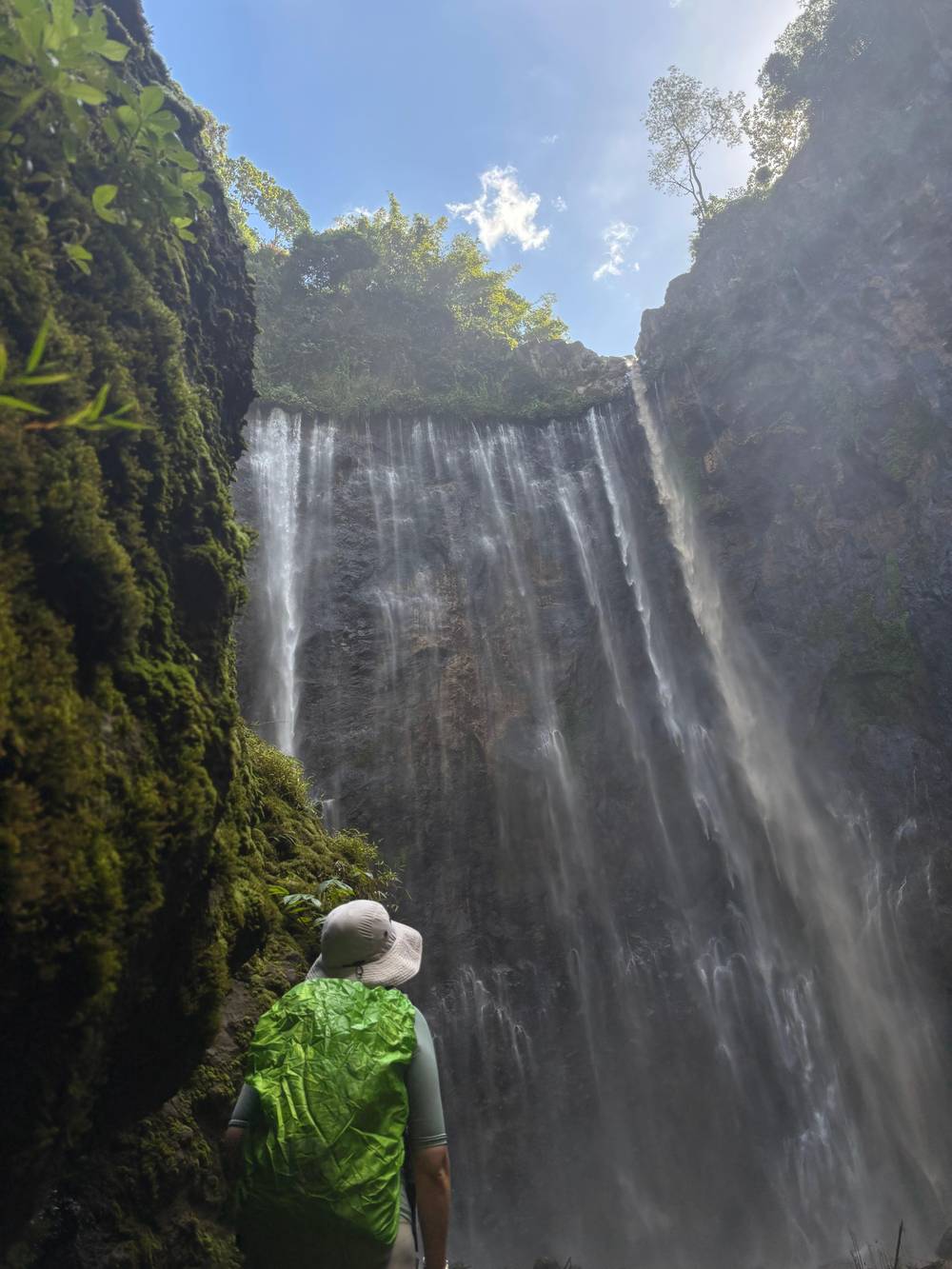
From the upper viewpoint you can capture the whole formation of water curtains at once. From the valley floor you stand right in front of the falling water.
Kit and plan for the valley
By private vehicle from Malang you should allow 2 to 3 hours to reach the falls.17 The shared day trip on this site is a 10-hour day: 2.5 hours of driving out, 3.08 hours at the falls, 30 minutes for lunch and 3 hours of driving back. That is the frame you are fitting the viewpoints into.
That listing walks the panorama first and only then goes down for 40 to 60 minutes, with a further 30 minutes to Goa Tetes and 3 to 4 hours at the falls in total. Seen that way, the panorama is the warm-up, the base is the main event and the cave waterfall is the extra if the group is still moving well.
Self-drivers should note the 15.00 WIB closing time and put the descent early.6 The listing says the group is accompanied by a local trekking leader, there for safety and not a professional guide; think of that person as a safety presence rather than a lecturer. If you want explanations of what you are looking at, read up before you go.
FAQ
That is the walk from the car park to the upper viewpoint.1
The silhouette of Semeru shows in the background of the main viewpoint when the sky is clear.5
GNFI reports that the site is open every day within those hours.6
The integrated ticket of 24 December 2024 took in the waterfall, Goa Tetes and Panorama Grojokan Sewu.15
Sources
Wondering about the falls or the ladders? Ask a person here.